Route & what to see
|
A Blackheath Village Walk Route & what to see |
| london-footprints.co.uk |
Blackheath is a comparatively new village which grew up in the 1820's to cater for the middle classes moving into the area; a development which increased with the coming of the railway in 1849. There are lots of attractive buildings both large and small to view and some quite ‘rural’ sections on this 3 mile circular walk from Blackheath Station. There are plenty of places for refreshments in the Village. The Age Exchange Centre opposite the station is worth a visit. It has displays, community library, a shop and cafe.
From Blackheath Station go
right along Blackheath Village
The station, designed by George Smith, was built on the site of
Hally’s Nursery. Lloyds Bank took over the the former
Alexandra Hall and Swimming Bath (built 1863) in 1928. Selwyn
Court was built in 1936 on a site previously occupied by the
Proprietary School (1835-1907).
Cross over to the Conservatoire
(1896) and Concert Hall (1895). Just past this go left through
the gates along Blackheath Park
This is part of the Cator Estate, developed in the 1820s by John
Barwell Cator, which has a number of attractive houses in a
variety of styles. The Gables and Windermere are by Philip Aston
Webb and number 10 by Patrick Gwynne (1968). St Michael & All
Angels Church was designed by George Smith and built in 1828-30
as a proprietary chapel. The junction here marks the site of
Gregory Page’s Wricklemarsh House of 1723 by John James.
Go right along Foxes Dale and
left at Brookway
At the end is a pond.
Left along Brooklands Park
Brooklands was designed and built by local architect George Smith
as his home in 1825.
Continue along Blackheath Park to
the right
There are a number of Span houses of 1958-63.
Go left into Morden Road
This continues through the Cator Estate. Just beyond the gates to
the right is Morden College, attributed to Christopher Wren.
These almhouses were built in 1695 with funds provided by John
Morden to house merchants who had fallen on hard times.
Continue into South Row
To the left is the Grade I listed Paragon of 1794-1805 designed
by Michael Searles. The original 14 houses were re-developed as
100 flats after WWII bomb damage. Colonnade House was built in
1804 and Paragon House (also by Searles) in 1794. Pond Road is
the former drive to Wricklemarsh House. At the end of the road is
the Prince of Wales Pond and the Princess of Wales pub named
after Caroline of Brunswick, wife of George IV. The English team
for the first rugby international was selected here in 1871.
Continue along Montpelier Row
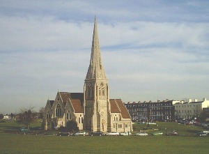
On the right is All Saints Church built in 1857 by Benjamin
Ferrey as the village's parish church.
Go through Tranquil Passage to
the right
This triangular area had a temporary Wesleyan Chapel, a dairy,
some outbuildings and some insanitary houses until 1866 when it
was cleared during the development of Royal Parade. A village
school was built to take 120 pupils in 1851 on the site of Queen
Elizabeth’s Well. The school remained in use until 1939. The
building later became a library (in 1965) and then commercial
premises. Some small shops built in the 1870s remain.
Go right through Brigade Street
This street was developed in the 1870s with houses and workshops.
At the end is an old fire station building used until 1909.
The street emerges into Royal
Parade
The area of heath opposite was known as Washerwoman’s Bottom
as it was used to dry clothes.
Go left at Royal Parade then
cross and go left along Tranquil Vale.
The Crown pub has been in existance since 1758. Adjacent was the
old post office. A little further along are some attractive late
18th century weather boarded cottages in Collins Square which
were restored in the 1960s. Opposite O’Neills was formerly
the Three Tuns (still depicted) which has been on the site since
1726.
Go right at Collins Street and
right along South Vale Road
Houses were constructed here in the 1860s and 1870-1 respectively
The road emerges at Tranquil
Vale
On the corner is the Mary Evans Picture Library (housed in the
former parish hall of 1927-8)
Go left into Camden Row
Overcrowded and unsanitary houses were cleared from here and the
present houses built in the 1890s. Many have attractive tiles.
Continue through Grotes
Buildings
These were constructed in the 1760s on land belonging to the
Morden Estate (note property marks). At the end is the Hare &
Billet pub overlooking the pond of the same name.
Continue along Eliot Place
There is a blue plaque on the home of polar explorer James Clark
Ross
Continue along Eliot Vale and
go left into Pagoda Gardens
The chinese style building was a summerhouse for Montagu House,
both used by Caroline of Brunswick. Montagu House, which stood
next to Ranger's House on the edge of Greenwich Park was
demolished in 1815.
Return along Eliot Vale and go
left along Heath Lane which becomes a footpath. Go left at Lee
Terrace, right at Dacre Park and left along Quentin Road.
Continue right along Lee Terrace then left around Lawn Terrace.
On the left is the Quaker Meeting House (1974) and former
Congregational Church (1853/1957). The 'Tea Caddy' houses at
numbers 11-17 were built as Seager's Cottages.
At the end go left back to the
station.
The former School for the Sons & Orphans of Missionaries
(built 1857) has been taken over by the Blackheath Hospital.
Resources
Blackheath Village & Environs by Neil Rhind
Village London by Andrew Duncan
london-footprints.co.uk 2014